Categories
Uncategorized

3D Printing Buildings & Terrain

«insert weak joke about a small, transparent city hall here»
Pocket Eildon Hill (rustic edition) for homesick Borderers

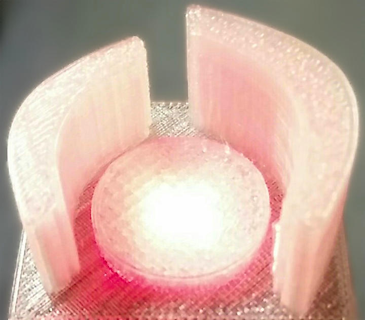
Based on Selasi Dorkenoo and Claus Rinner’s presentation at Toronto #Maptime – 3D Printing Demo. More later.

Categories
GIS

Maptime Toronto talk — tomorrow!

I’m talking about data and tools at Maptime Toronto tomorrow. Here are my slides: maptime201511-tools_and_data.

Categories
Uncategorized

Kirkby Fleetham Proposed Pit (MJP60)

See full screen

for more details, please see:
Minerals and waste joint plan consultation – North Yorkshire County Council http://northyorks.gov.uk/article/23999/Minerals-and-waste-joint-plan-consultation
Outline traced from http://northyorks.gov.uk/media/30250/Supplementary-sites-consultation—January-2015/pdf/Supplementary_sites_Consultation-_Web_Version.pdf

Update: After reading Anita’s article about Publishing interactive web maps using QGIS, I had to try the QGIS2leaf plugin. And lo! It works:

though, to be fair, this is just a static screen dump; click on the image for the live map …

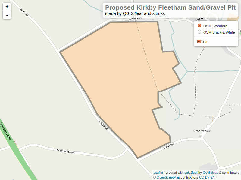
Joshua Frazier’s great tutorial Let’s make some web maps using Leaflet.js! for Maptime Toronto was a huge help in getting me started with Leaflet. Thanks, Joshua!

Categories
Uncategorized

Summary of my off-the-cuff Maptime Presentation: Canadian Microwave Links

Screenshot from 2014-07-26 10:17:15
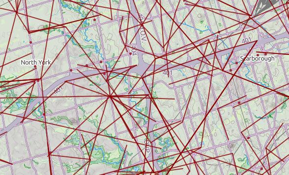
@MaptimeTO asked me to summarize the brief talk I gave last week at Maptime Toronto on making maps from the Technical and Administrative Frequency List (TAFL) radio database. It was mostly taken from posts on this blog, but here goes:

  1. One of the many constraints in building wind farms is allowing for radio links. Both the radio and the wind industries have agreed on a process of buffering and consultation. Here’s how I handled it in Python: Making weird composite shapes with Shapely.
  2. The TAFL databases — which contains locations and technical data for all licensed transmitters — are now open data. You can find them here: Technical and Administrative Frequency List (TAFL).
  3. The format is a real delight for all legacy-data nerds: aka a horrible mess of conditional field widths and arcane numeric codes. I wrote a SpatiaLite SQL script to make sense of it all: scruss/taflmunge. This (kind of) explains what it does: TAFL — as a proper geodatabase.
  4. Here’s a raw dump (very little metadata, sorry) from 2013 in the wonderful uMap: Ontario Microwave Links.
  5. In a fabulous piece of #opendatafail, Industry Canada have migrated all the microwave data (so, all links ≥ 960 MHz) to a new system which doesn’t work yet, and also stripped out all of the microwave data from recent TAFL files. They claim to be fixing it, but don’t hold your breath. If you want data to play with, here’s Ontario’s data from October 2013 (nb: huge) — ltaf_ont_tafl-20131001.