Note: I’ve had reports that some carriers seem to disable GPS service within their service area. I’ve certainly seen slight differences as to how this works on different carriers.
Most recent camera-equipped Blackberrys have a GPS built in. One of the most handy things I’ve found for fieldwork is the ability to take pictures tagged with your location and be able to send them to contacts.
Setting this up is a little involved. First, go into the camera, and selection ‘Camera Options’. You want to enable Geotagging:
 (oh, and I took the screen capture with CaptureIt). Save options, then exit back to the home screen.
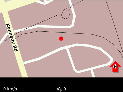
I find the most reliable way of starting the GPS is to go into Blackberry Maps, and ‘Start GPS Navigation’ from the menu. Once you’ve got a reliable satellite fix (which on my old Curve, used to work fine indoors; on my Tour, not so well) you should be able see the map update with your current location, and a satellite count (9 here) on the bottom of the screen:
 Exit maps, and start your camera. You’ll know if you have a location for tagging if there’s an icon that looks a bit like
  in the bottom right corner of the screen. With no fix, it’s a red crossed-through icon. Now take your picture!

(yeah, my Blackberry takes slightly fuzzy pictures. Dunno why.)
Metadata’s only useful if you can read it, and on anything with a command line, ExifTool works really well:
$ exiftool IMG00144-20100411-1516.jpg
 ...
GPS Position                    : 43.709983 N, 79.239817 W
(one should note that without a barometric pressure sensor, GPS altitude readings are not to be trusted. This picture claimed to be taken at 120 m Below Sea Level …)
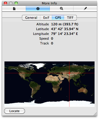
Curiously, OS X’s Preview gets GPS position completely wrong:
 According to Preview, I and my bike (and my Blackberry) were close to Charyn in Kazakhstan. I’m quick on my pedals, but not good enough to get far east in an afternoon.
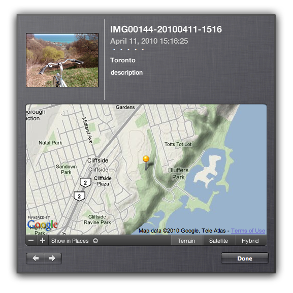
iPhoto gets it right, though:
 Curiously, I couldn’t find anything built into Windows (okay, XP) that would read the tag location. I guess Microsoft just don’t want you to know where you are now, merely where do you want to go today.
 (oh, and I took the screen capture with CaptureIt). Save options, then exit back to the home screen.
 Exit maps, and start your camera. You’ll know if you have a location for tagging if there’s an icon that looks a bit like
 According to Preview, I and my bike (and my Blackberry) were close to Charyn in Kazakhstan. I’m quick on my pedals, but not good enough to get far east in an afternoon.
 Curiously, I couldn’t find anything built into Windows (okay, XP) that would read the tag location. I guess Microsoft just don’t want you to know where you are now, merely where do you want to go today.
