Categories
GIS

Garmin autorouting: hilarity ensues

Garmin preferred route via I 69 slip-road at I 94 junction

Well, that was fun … because the slip-road at the I 69/I 94 junction in central Michigan is a slightly shorter route than continuing on the I 69, The Algorithm (which cannot be Questioned) routed me off the I 69 then back on again.

These self-driving cars, I dunno … least useful innovation ever.

Categories
Uncategorized

Mephisto’s Oriental Mystery — solved!

I bought a pair of Mephisto shoes today, and to go with their wayfaring imagery, the insoles are decked out with map-like symbols. Prominent is a map coordinate: N 38° 51.343′ E 94° 47.963′.

If you look at a map there, it’s a fairly empty mountainous place near the border of Qinghai and Gansu. It’s definitely not where the shoes are made, unless Mephisto have a stealth factory there.

There was something familiar about the coordinate, through. I thought I’d try flipping it to the western hemisphere:

It’s the Garmin headquarters in Olathe, KS! Every Garmin GPS I’ve ever owned has had the HQ as a default waypoint. I’m guessing a designer at Mephisto was looking to add something legitimately mappy to the graphics, and picked up their satnav to pull out a coordinate. Guessing that Olathe isn’t a very mysterious, rugged destination, they flipped the hemisphere to give it more eastern promise.

Categories
Uncategorized

Updating maps … to outdated data

I caved, and bought a Garmin nüvi 1490. Not that my GPSMap 60CSx wasn’t great at routing, but remembering to update maps before travel and its fiddly mounting requirements were a pain.

So, two hours of downloading map updates, and I fire it up … to find that the three year old hotel in Dartmouth, NS we were staying in was in the wrong place on the map:

Compare with OpenStreetMap:

So now, back near home, I ask it to find a post office. Here’s me parked outside one; do you see it on the screenshots?

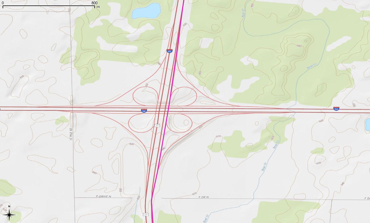
Again, compare with OpenStreetMap:

So I thought I’d help Garmin out, but their Report a Map Error page needs me to know the type of my GPS, its serial number, the type and revision of my map, my name and e-mail address, and the coordinates of the error. OSM has me spoiled: at best, I can go in and edit; at second best, I can drop markers on OpenStreetBugs to flag errors for others to fix.

Garmin already has my name, e-mail address, GPS type, serial number and map revision through myGarmin™. The company could just as easily have a web-based map correction system that would be point-and-click. Follow the Leader is one of Garmin’s mottoes. In terms of user correctability of maps, however, they’re only the leader because they don’t know they’ve been lapped.

Categories
GIS

Garmin vs Arduino GPS dance-off

So I built a GPS logger. It’s an Arduino Uno with the SparkFun microSD and GPS shields. No display, massively unwieldy, but it does spit out a track point every second and logs it fairly reliably to microSD. It works as well as my expensive old Garmin GPSMap 60Csx, as a walk around the block shows:

Excuse the noise at the top of the trace; both units were brought inside. While they keep a tenuous lock, they certainly don’t give much accuracy. I think the Arduino did rather well; certainly better than my BlackBerry

Now all I need is a case and a more useful power supply. I was disappointed that a USB MintyBoost charger didn’t seem to work for long, causing the GPS to lock up.

Categories
GIS

fixing garmin file dates

While the Garmin GPSMap 60csx is a lovely unit, it saves its tracks on the card with a date just slightly younger than I am. The following Unix one-liner will correct the file dates to the actual dates the data were collected:

for f in 20??????.gpx; do touch -t ${f%.gpx}2359.59 $f; done

I remember having a really awesome reason for making the time for each file 23:59:59, but I’ve completely forgotten what it was. Since all I remember was the awesomeness, I see no reason to change it …

Update 2013-09-25: changed the call to basename with a Bash internal string function.

Categories
Uncategorized

Mac OS X killed my Garmin!

My GPSMAP 60CSx had started to become unreliable: crashing after startup, randomly locking up in mid route, and just generally being an aggravating piece of kit. I was really close to replacing it.

The problem seemed to appear after I’d used USB Mass Storage to transfer archived track logs to the computer. As a last resort, I tried removing the hidden files that OS X creates on every removable disk, and now all is well. It’s annoying and inexcusable that Apple chooses to do this, but we work around.

To delete these files from the terminal and eject the device safely, enter these commands:

pushd /Volumes/GARMIN/
rm -rf .Spotlight-V100 .Trashes ._.Trashes .fseventsd
popd
disktool -e disk1

Your device might not be called /Volumes/GARMIN/, so check and change appropriately. If you have multiple drives on your machine, your GPS is probably not the disk1 device. You can find out which it is by entering disktool -l.

Categories
Uncategorized

probably wouldn’t recommend the Blackberry Tour as a GPS logger

I walked a local footpath carrying my (mostly) trusty Garmin GPSMap 60Csx, and a Blackberry Tour running bbTracker. Both had had a good satellite fix for about 10 minutes beforehand, and both were logging trackpoints every second. The smooth turquoise track from the Garmin is much more useful than the wibbly one from the Blackberry.