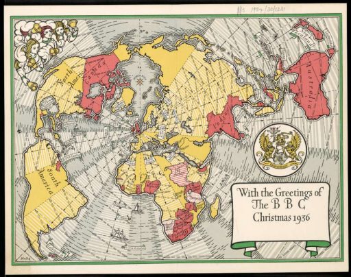
Source: National Library of Australia — “With the greetings of the BBC. Christmas 1936” Promotional christmas card with schematic world map produced by the British Broadcasting Corporation.
(indirectly via Rupert Goodwins.)

Source: National Library of Australia — “With the greetings of the BBC. Christmas 1936” Promotional christmas card with schematic world map produced by the British Broadcasting Corporation.
(indirectly via Rupert Goodwins.)
Update: thanks to André, this works! See the updated ogr2ogr line.
All I really wanted to do is make a map like this:
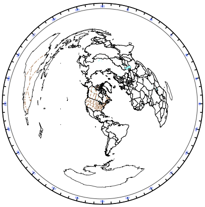 This is an Azimuthal Equidistant projection, with me at the centre (of course) and the rest of the world spread out in a fan by distance and bearing. It’s somewhat surprising to find that South Africa is almost directly east of Toronto, and New Zealand to the southwest.
If I had a directional antenna and a rotor, this map would show me where I would have to point the antenna to contact that part of the world. I can’t rotate my dipole (unless I commit some unauthorized local plate tectonics) so I’m stuck with where my antenna transmits and receives best.
The above map was made with AZ_PROJ, a PostScript program of some complexity for plotting world maps for radio use. The instructions for installing and running AZ_PROJ are complex and slightly dated. I got the above output running it through Ghostscript like this:
gs -sDEVICE=pdfwrite -sOutputFile=va3pid_world.pdf az_ini.ps -- az_proj.ps world.wdb
The format of the az_ini.ps file is complex, and I’m glad I’m an old PS hacker to be able to make head or tail of it.
For all its user-hostility, AZ_PROJ is powerful. Here’s a version of the map I wanted all along:
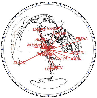 This shows my furthest QSO in each of the 16 compass directions. (You might note that North is empty: my furthest contact in that direction is some 13km away, whether by lack of folks in that sector or dodginess of my antenna.) Contrast that with my Mercator QSO map, and you’ll see that Azimuthal Equidistant is a much better projection for this application.
To show how radically different the world looks to different people, here’s the world according to my mate Rob in Hamilton, NZ:
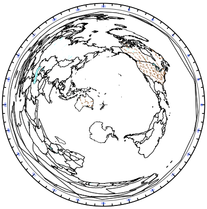 I’d been trying to use OGR to transform arbitrary shapefiles into this projection. For maps entirely contained within the same hemisphere (so having extent less than ±90° in any cardinal direction), this works:
ogr2ogr -t_srs "+proj=aeqd +lat_0=43.7308 +lon_0=-79.2647" out.shp in.shp
The lat_0 and lon_0 parameters are just where you want the centre of the map to be. Things get a bit odd if you try to plot the whole world:
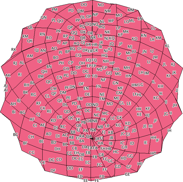
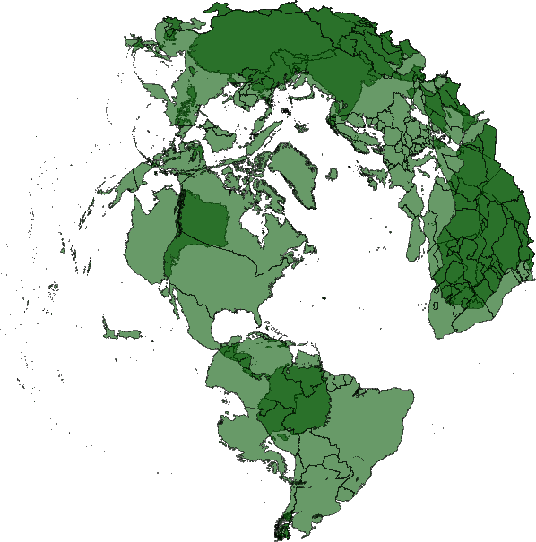 The antipodes get plotted underneath, and everything looks messed up. I may have to take my question to GIS – Stack Exchange to see if I can find an answer. Still, for all its wrongness, you can make something pretty, like my whole world Maidenhead locator grid projected this way turns into a rose:
Update: André advised on Stack Exchange that you need to specify the correct radius:
ogr2ogr -t_srs "+proj=aeqd +lat_0=43.7308 +lon_0=-79.2647 +R=6371000" va3pid-world.shp TM_WORLD_BORDERS_SIMPL-0.3.shp
This works rather well: