Update, 2015: I don’t think this coverage works any more. The WMS data was carefully trimmed to the US border last time I looked.
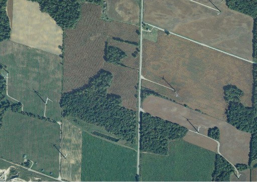
Detail of Erie Shores Wind Farm showing USGS orthophotos from WMS
I was trying to do some OpenStreetMap edits in rural southern Ontario, but the default Bing background aerial imagery is very poor. Clicking around in semi-plokta mode to find better images, I happened upon “OSM US USGS Large Scale Aerial Imagery”, which loaded up some beautiful and recent pictures. I guess that since we’re close to the border, the USGS doesn’t bother to trim its images too close.
Ian Dees, who admins the particular OSM server, confirmed that these are from The National Map‘s TNM_Large_Scale_Imagery service; thanks, Ian! These images are at least as good for my purposes as the SWOOP data — except not $50/km2, and without elaborate usage restrictions.
