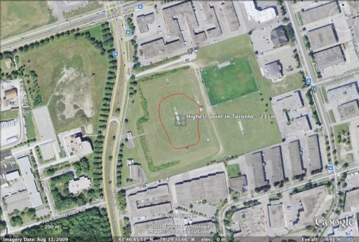
The highest point in Toronto has an elevation of 211m, and appears to be in the middle of one of York University‘s playing fields, just southwest of Keele & Steeles W:
 The red blob is the 211m contour, and the centre point is at 43.779325°N, 79.492655°W. The contour was derived from the MNR DEM data for the province.
The city says the highest point is 209 m (at intersection of Steeles Ave West and Keele St), which is pretty close in all three axes.