
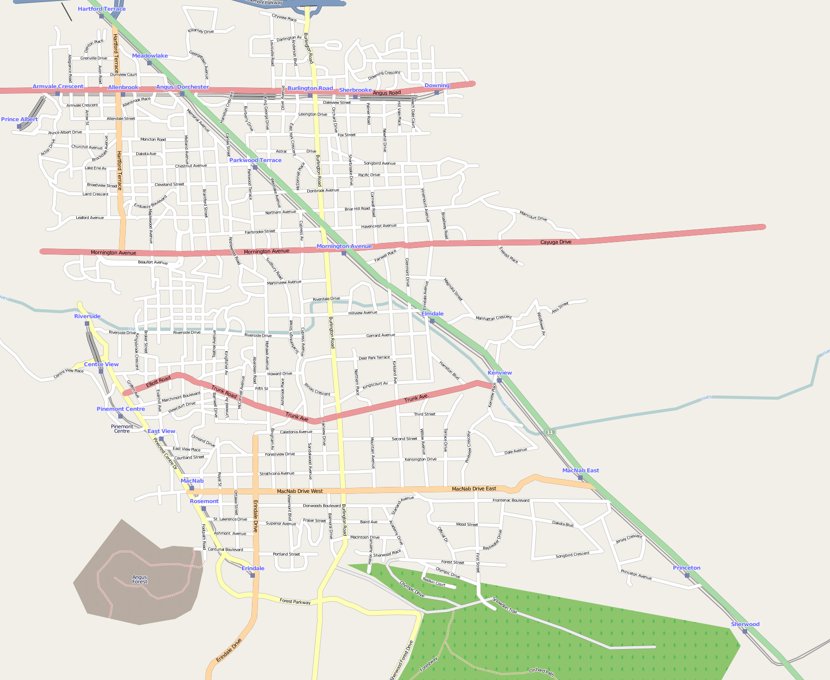
There’s not a whole lot north of North Bay. Highway 11 winds through some extensive geometry, but few habitations. Until something wonderful (and quite a bit wrong) happened at 46° 31′ 21″ N, 79° 33′ 9″ W on OpenStreetMap. A whole new town about 25 minutes out of North Bay sprung up overnight — and was as quickly deleted as mappers caught and reverted the vandalism.

The misguided mapper put quite a lot of work into this ephemeral town. It’s got urban rail, parklands, residential areas and more. You can see the detail on this large image of the town (650 KB PNG). If you want to play with the data, here’s a zipped OSM XML file of the area before it was reverted. But please, don’t re-upload it; OpenStreetMap should be for real features on the ground, and not for confusing map data consumers.
Thanks to Bootprint for noticing this, and to rw__ for reverting the edits.