Hey, they’ve updated most of the data sets on toronto.ca | Open!
Tag: free
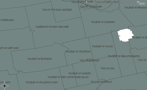
 The Ontario Ministry of Natural Resources has a fairly well-hidden service that provides free geodata to the general public. One has to register with a sign and e-mail form, but there’s a large number of useful data sets available. The only disadvantage is that you can’t tell if your order will be delivered by download, or physically burnt to DVD and mailed from the MNR in Peterborough. The municipalities shown above were a download; the DEMs of my entire UTM zone? They’re in the mail …
untangling CanVec
It’s almost as if NRCan doesn’t want anyone to use CanVec. I mean, it’s a free and comprehensive data set for the whole country; anyone who can type in a postal code and click a couple of times can download the CanVec map tile for where they live. But on the other hand, cracking open that download reveals an impenetrable mess of information that probably makes most users go away.
I’ve played with it before, and do occasionally drag out a layer at work, but have never got much further than that. GIS types must be very quiet, because Using CanVec – maphew and CanVec – OpenStreetMap Wiki are about the only public discussions of its content.
CanVec is delivered in two formats: Geography Markup Language (GML), and our friend, the Shapefile. While the GML version contains relatively few files, all the tools I have choke on the data. So shapefiles it is.
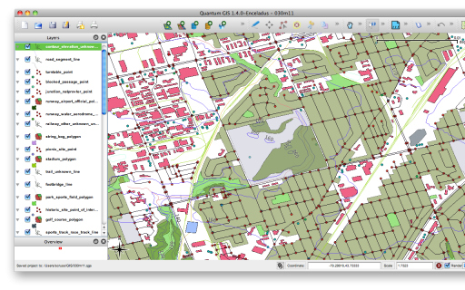
Opening up the archive for the Toronto area (it’s tile 030m11) I see 192 files. Four of those are (not very useful) metadata files. Realising that a shapefile ships as four files (the mandatory shp, dbf and shx files, plus the optional prj file) that’s 47 layers. The file names look a bit like this: 030m11_6_0_BS_1250009_0.shp, 030m11_6_0_BS_1370009_2.shp, 030m11_6_0_BS_2010009_0.shp. The names really do mean something:
030m11_6_0_BS_1370009_2.shp
|--+-| |+| |----+-----|
   |    |        \ Layer Code and Type
   |    \ Version
   \ Map tile
CanVec – Entity Names and Codes, Edition 1.1.0 (XLS) explains the layers, and how they relate to the shapefile names. Rather than relating unique layer codes to layer descriptions, the Entity Names & Codes document has it backwards. So I made the much simplified canvec_simple-20100523.csv which lists layer codes against attributes in a more sensible manner. I added a derived ‘name’ column, which I use for layer naming from these files. The layers use EPSG:4617 (NAD83 CSRS) coordinates.
Tip of the hat to maphew – Revision 123: /trunk/gis/canvec for providing a file that was the ‘Aha!’ moment.
free geodata for the numpty-about-Toronto
So if I want to learn some GIS skills, it would be helpful if I had some data to work with. Here are two data sources I have slight familiarity with:
Shapefiles, comprising:
- Municipal Address Points – Toronto One Address Repository (November 2009 – MTM 3 Degree Zone 10, NAD27)
- Business Improvement Areas (BIA) (2009 – MTM 3 Degree Zone 10, NAD27)
- Toronto Centreline (TCL) (2009 – MTM 3 Degree Zone 10, NAD27)
- Food Banks (October 2009 – UTM 6 Degree Zone 17N NAD27)
- Neighbourhoods (October 2009 – UTM 6 Degree Zone 17N NAD27)
- Parks (October 2009 – MTM 3 Degree Zone 10, NAD27)
- Priority Investment Neighbourhoods (October 2009 – UTM 6 Degree Zone 17N NAD27)
- Places of Worship (2006 – UTM 6 Degree Zone 17N NAD27)
- Rent Banks (2007 – UTM 6 Degree Zone 17N NAD27)
- Rent Bank Zones (2007 – UTM 6 Degree Zone 17N NAD27)
- Solid Waste Management Districts (October 2009 – MTM 3 Degree Zone 10, NAD27)
- Transit City (October 2009 – UTM 6 Degree Zone 17N NAD27)
- City Wards (2009 – MTM 3 Degree Zone 10, NAD27)
The mixed map projections are a bit of a pain, and there are reports that some of the data is skewed from the rest of the Canadian data, but there’s much to love about this data.
GeoGratis, from Natural Resources Canada
An absolute tonne of data, in vector and raster formats. Services I’ve used are CanVec (vector data covering almost every feature) and Toporama (raster topographic maps; it has an associated Toporama Web Map Service).
